搜索结果: 1-15 共查到“知识库 工学 Image”相关记录1212条 . 查询时间(0.397 秒)
IMAGE RECORDING CHALLENGES FOR PHOTOGRAMMETRIC CONSTRUCTION SITE MONITORING
Image Recordings Recording Challenges Construction Site Monitoring Photogrammetry Construction
2019/3/4
Construction site monitoring and progress monitoring is becoming increasingly popular in the architecture, engineering and construction (AEC) industry. To this end remote sensing techniques are used t...
3D IMAGE BASED GEOMETRIC DOCUMENTATION OF A MEDIEVAL FORTRESS
3D model Orthophoto UAV Laser Scanning Photogrammetry
2019/3/4
The detailed and thorough documentation of monuments is a rather complex process that requires the application of the best available state of the art techniques in order to preserve, restore, promote ...
MODELLING BUILDING COSTS FROM 3D BUILDING MODELS – ESTIMATING THE CONSTRUCTION EFFORT FROM IMAGE-BASED SURFACE MODELS OF DRY-STONE SHEPHERD SHELTERS (KRAS, SLOVENIA)
Architectural energetics Biomechanics Caloric expenditure Dry-stone building
2019/3/4
In the second half of the 19th and early 20th century, sheep shepherds have built dry-stone shelters all over the Slovene Kras (or Karst) region. Despite being made out of stones that are interlocked ...
SEMANTIC PHOTOGRAMMETRY – BOOSTING IMAGE-BASED 3D RECONSTRUCTION WITH SEMANTIC LABELING
image-based 3D reconstruction label transfer semantic photogrammetry dense image matching
2019/3/4
Automatic semantic segmentation of images is becoming a very prominent research field with many promising and reliable solutions already available. Labelled images as input for the photogrammetric pip...
A WEB-BASED VIRTUAL LABORATORY FOR SATELLITE IMAGE PROCESSING AND ANALYSIS
Education Satellite Image Processing E-Learning Tool Web-based Virtual Laboratory
2019/2/27
With continuous increase in the utilization of satellite images in various engineering and science fields, it is imperative to equip students with additional educational aid in subject of satellite im...

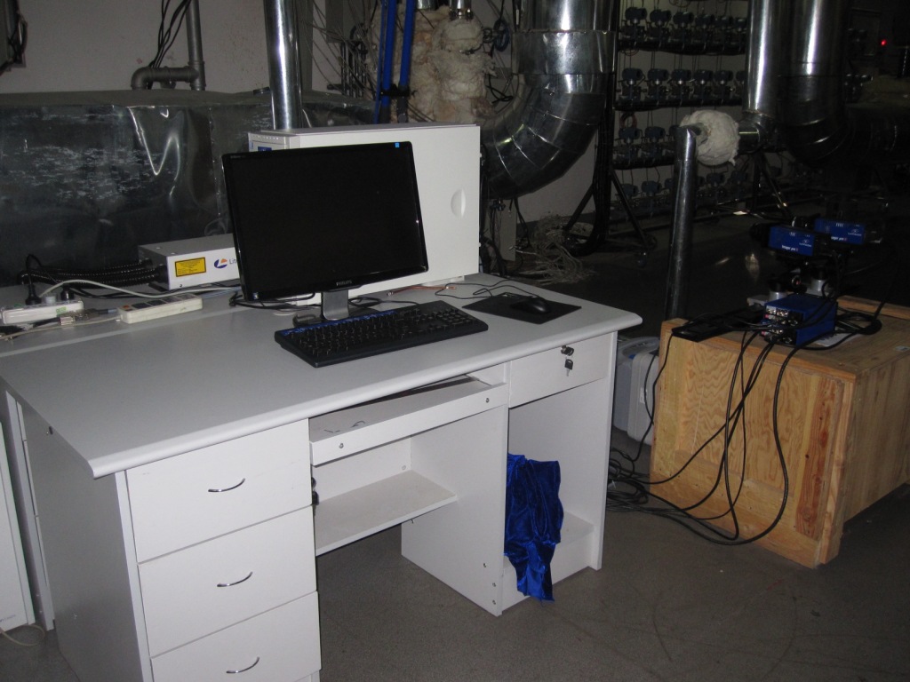
PIV粒子示踪仪 Particle Image Viewer(图)
粒子示踪仪 湍流场测量 重点实验室 激光
2023/8/8
中文名称:PIV粒子示踪仪 Particle Image Viewer,主要功能:粒子成像测速系统 可测量高温流体的速度场; 可测量微小空间的流体; 利用激光的照亮流场,使用快速成像的数码相机进行流场的测量技术; 风洞中流场的测量; 湍流场测量。
IMAGE CLASSIFICATION FOR MAPPING OIL PALM DISTRIBUTION VIA SUPPORT VECTOR MACHINE USING SCIKIT-LEARN MODULE
Landsat oil palm Python remote sensing Scikit-learn support vector machine
2018/11/9
The world has been alarmed with the global warming effects. Global warming has been a distress towards the environment, thus shorten the Earth’s lifespan. It is a challenging task to reduce the global...
IMAGE-BASED METHOD FOR THE PAIRWISE REGISTRATION OF MOBILE LASER SCANNING POINT CLOUDS
pairwise registration relative registration image registration template matching
2018/11/9
In this paper, a method is proposed for solving relative translations of 3D point clouds collected by Mobile Laser Scanning (MLS) techniques. The proposed approach uses the attributes of the 3D points...
IMAGE QUALITY ASSESSMENT OF HIGH-RESOLUTION SATELLITE IMAGES WITH MTF-BASED FUZZY COMPREHENSIVE EVALUATION METHOD
Image Quality Assessment High-resolution Satellite Images MTF Fuzzy Comprehensive Evaluation
2018/5/15
A Modulation Transfer Function (MTF)-based fuzzy comprehensive evaluation method was proposed in this paper for the purpose of evaluating high-resolution satellite image quality. To establish the fact...
COMBINING HIGH SPATIAL RESOLUTION OPTICAL AND LIDAR DATA FOR OBJECT-BASED IMAGE CLASSIFICATION
High Spatial Resolution Lidar Object-Based Classification Aerial Image Image segmentation
2018/5/14
In order to classify high spatial resolution images more accurately, in this research, a hierarchical rule-based object-based classification framework was developed based on a high-resolution image wi...
ANALYSIS OF THE IMAGE QUALITY OF NO GROUND CONTROLLED POSITIONING PRECISION ABOUT SURVEYING AND MAPPING SATELLITE
Positioning accuracy Modulation Transfer Function Signal to Noise Ratio Quantization Bits degradation data
2018/5/15
The image quality of the surveying camera will affect the stereoscopic positioning accuracy of the remote sensing satellite. The key factors closely related to the image quality are Modulation Transfe...
A STATISTICAL TEXTURE FEATURE FOR BUILDING COLLAPSE INFORMATION EXTRACTION OF SAR IMAGE
Synthetic Aperture Radar (SAR), Building Collapse Information, Texture, G0 Distribution, Texture Parameter
2018/5/14
Synthetic Aperture Radar (SAR) has become one of the most important ways to extract post-disaster collapsed building information, due to its extreme versatility and almost all-weather, day-and-night w...
RESEARCH ON COORDINATE TRANSFORMATION METHOD OF GB-SAR IMAGE SUPPORTED BY 3D LASER SCANNING TECHNOLOGY
GB-SAR Interference measurement 3D laser scanning Coordinate Transformation
2018/5/15
In the image plane of GB-SAR, identification of deformation distribution is usually carried out by artificial interpretation. This method requires analysts to have adequate experience of radar imaging...
THE APPLICATION OF CHINESE HIGH-SPATIAL-RESOLUTION REMOTE SENSING SATELLITE IMAGE IN LAND LAW ENFORCEMENT INFORMATION EXTRACTION
land use high resolution batch process geoprocessing model information extraction mapping
2018/5/15
Chinese high -resolution (HR) remote sensing satellites have made huge leap in the past decade. Commercial satellite datasets, such as GF-1, GF-2 and ZY-3 images, the panchromatic images (PAN) resolut...
APPLICATION OF MULTI-SOURCE REMOTE SENSING IMAGE IN YUNNAN PROVINCE GRASSLAND RESOURCES INVESTIGATION
Remote Sensing Image Grassland Resources NDVI Grassland Degradation Vegetation Coverage Ecological Protection
2018/5/14
Trough mastering background information of Yunnan province grassland resources utilization and ecological conditions to improves grassland elaborating management capacity, it carried out grassland res...

