
搜索结果: 1-15 共查到“信息与通信工程 Range”相关记录19条 . 查询时间(0.027 秒)
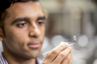
UW team shatters long-range communication barrier for devices that consume almost no power(图)
UW team shatters long-range communication barrier consume almost no power
2017/9/20
University of Washington researchers have demonstrated for the first time that devices that run on almost zero power can transmit data across distances of up to 2.8 kilometers ― breaking a long-held b...
Given a set P of n uncertain points on the real line, each rep-resented by its one-dimensional probability density function, we consider the problem of building data structures on P to answer range qu...
Intensity Normalization by Incidence Angle and Range of Full-Waveform LIDAR Data
Laser Data Full-Waveform Point Clouds Intensity
2015/12/16
The analysis of LIDAR data to extract surface features is of great interest in photogrammetric research. Our investigations show that the same material of a surfaces (e.g. gabled roof) yields to diffe...
Integrated Registration of Range Images from Terrestrial LIDAR
Registration Range Image Spatial Transformation Terrestrial LIDAR
2015/12/8
There are generally two kinds of LIDAR, airborne and terrestrial. Terrestrial LIDAR is outstanding for its high accuracy, hyper speed and high density. A single range image of terrestrial LIDAR usuall...
A Review of Recent Range Image Reconstruction Algorithms
Laser scanning (LIDAR) Reconstruction Computer Vision Comparative analysis Process modeling
2015/12/8
Preparing virtual models by data acquired from indoor and outdoor objects, comprehensively, have been ingratiated with specialists of geomatic science. Since previous years, specialists of computer sc...
Intensity Calibration and Imaging with SwissRanger SR-3000 Range Camera
Calibration Infrared Image Camera LIDAR Radiometry Close Range
2015/12/4
Intensity images acquired with range imaging instruments can be used in the future for various applications, e.g. face recognition, assisting blind people in travelling and walking, automatic robotic ...
THE APPLICATION OF CONTENT-BASED INDEXING AND RETRIEVAL OF DIGITAL PICTURES AND RANGE IMAGES TO THE 3D VIRTUAL RECONSTRUCTION OF COMPLEX SITES AND ARCHITECTURES
Content-based indexing/retrieval model range images registration three-dimensional 3D
2015/10/8
The modelling of complex objects and sites involve the acquisition of a large number of texture maps and range images; each one of
them representing a particular viewing angle. These views must be c...
Architectures for High Dynamic Range,High Speed Image Sensor Readout Circuits
Architectures High Dynamic Range High Speed Image Sensor Readout Circuits
2015/8/17
The stringent performance requirements of many infrared imaging applications warrant the development of precision high dynamic range, high speed focal plane arrays. In addition to achieving high dynam...
Comparative Analysis of SNR for Image Sensors with Enhanced Dynamic Range
CMOS Image sensor CCD Wide Dynamic Range APS Pixel level ADC
2015/8/17
Dynamic range is a critical figure of merit for image sensors. Often a sensor with higher dynamic range is regarded as higher quality than one with lower dynamic range. For CCD and CMOS sensors operat...
Synthesis of High Dynamic Range Motion Blur Free Image From Multiple Captures
CMOS image sensor dynamic range extension motion blur restoration motion detection photocurrent estimation saturation detection
2015/8/12
Advances in CMOS image sensors enable high-speed image readout, which makes it possible to capture multiple images within a normal exposure time. Earlier work has demonstrated the use of this capabili...
Nominal Signal Deformations:Limits on GPS Range Accuracy
Nominal Signal Deformations GPS Range Accuracy
2015/6/26
Satellite-based navigation requires precise knowledge of the structure of the transmitted signals. For GPS, accurate knowledge of the shape of the ranging codes is required to ensure no biases are int...
Multiple constellations and modernized GNSS signals promise to bring a wealth of ranging possibilities to navigation users. They offer improved geometry and redundancy, immunity to ionospheric errors,...
Bearing and Range Estimation Algorithm for Buried Object in Underwater Acoustics
Bearing Range Estimation Algorithm Buried Object Underwater Acoustics
2009/9/4
A new algorithm which associates (Multiple Signal Classification) MUSIC with acoustic scattering model for bearing and range estimation is proposed. This algorithm takes into account the reflection an...
基于Range-Doppler域相位补偿的ATI/DPCA数据配准方法
图像配准 相位补偿 方位向时间延迟
2009/4/30
合成孔径雷达通过沿航迹干涉(ATI)或天线相位中心偏置(DPCA)技术检测地面运动目标,需要对获得的不同通道数据进行方位向时间配准。该文首先根据测得的雷达参数进行粗配准,而后基于接收数据在Range-Doppler域内通过相位补偿思想精确估计两通道回波数据时间延迟,从而进一步提高数据配准精度。该方法无需插值操作,运算量小,仿真表明性能良好,可以满足实时配准要求。
REFERENCING OF IMAGES TO LASER SCANNER DATA USING LINEAR FEATURES EXTRACTED FROM DIGITAL IMAGES AND RANGE IMAGES
Close range photogrammetry terrestrial laser scanning image orientation line extraction range image
2016/2/29
This paper deals with the referencing of single images taken independently from the laser scanner (camera not mounted on the
scanner) to a laser scanner point cloud of the same scene. The single ima...