搜索结果: 1-15 共查到“工学 Identify”相关记录26条 . 查询时间(0.021 秒)


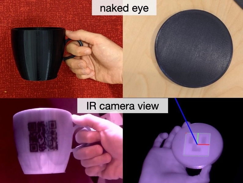
Invisible machine-readable labels that identify and track objects(图)
不可见 机器可读标签 3D打印标签 数据存储分类
2023/6/7

Researchers identify structure of 'blue whirls'(图)
Researchers identify structure blue whirls
2020/8/27
"Blue whirls" -- small, spinning blue flames that produce almost no soot when they burn -- have attracted interest since their discovery in 2016, in part because they represent a potential new avenue ...
Sense, Model and Identify the Load Signatures of HVAC Systems in Metro Stations
Sense Model Identify Load Signatures HVAC Systems Metro Stations
2016/1/22
The Heating Ventilation and Air Conditioning(HVAC) systems in subway stations are energy consuming giants,each of which may consume over 10, 000 Kilowatts per day for cooling and ventilation. To save ...
USING REMOTE SENSING TO SUPPORT DIFFERENT APPROACHES TO IDENTIFY AGAVE (Agave tequilana Weber) CROPS
Agave tequilana Tequila Unsupervised classification Landsat Jalisco
2015/12/28
There are several studies on tequila agave (Agave tequilana Weber variety blue) regarding its physiology, diseases, and environmental conditions. However, there are not documented studies on the use o...
This paper presents a method of identifying patterns among buildings and constructing relationships between them. It is envisioned that the pattern objects not only provide operands upon which general...
APPLICATION OF BINARY DIVISION ALGORITHM FOR IMAGE ANALYSIS AND CHANGE DETECTION TO IDENTIFY THE HOTSPOTS IN MODIS IMAGES
Binary Division Algorithm Change Detection Hotspot
2015/8/28
In this paper, an approach based on Binary Division Algorithm, to detect the Hotspots using
Multi-resolution fusion of band 1, band 2, band 31 and band 32 of Moderate Resolution Imaging
Spectroradio...
AN APPROACH TO DEVELOP INFORMATION SYSTEM FOR RADAR DATA TO IDENTIFY THE SHAPE OF SHALLOW BURIED METALLIC OBJECTS
Shallow buried objects image analysis monostatic scatterometer
2015/8/28
Present paper deals the fusion of image analysis and electromagnetic approach to predict the shape of the shallow buried metallic
objects for satellite remote sensing at X-band (i.e., 10 GHz). The sh...
THE APPLICATION OF REMOTE SENSING TO IDENTIFY AND MEASURE SEALED AREAS IN URBAN ENVIRONMENTS
Soil Urban Sealing Object classification segmentation mapping QuickBird
2015/8/19
Numerous studies have used satellite images for mapping urban land cover and land use along with modelling green spaces and surface impermeability. Recently, monitoring the percentage of sealed soils ...
AN APPROACH TO IDENTIFY AREA-SPECIFIC LAND USE ANALYSIS OBJECTIVES
Land use soils land use analysis objective Conservation Crop Management Improvement
2015/7/30
Maps of land use classes and soil series were analysed to identify areas having specific priorities with respect to agricultural land use
analysis under the project Integrated Mission for Sustainabl...
Analysis of coniferous species to identify and distinguish juvenile and mature wood
differentiation methods k-means algorithm forest management
2015/5/5
We conducted to describe methods used to differentiate the zones of juvenile and mature wood in
stems of coniferous species and to present the importance of good identification of the shares of both...
New Tracers Can Identify Coal Ash Contamination in Water
New Tracers Coal Ash Contamination Water
2014/12/30
Durham, NC - Duke University scientists have developed new forensic tracers to identify coal ash contamination in water and distinguish it from contamination coming from other sources.“These new tools...


