搜索结果: 1-15 共查到“recharge”相关记录48条 . 查询时间(0.09 秒)

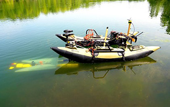
What if underwater robots could dock mid-mission to recharge and transfer data?(图)
underwater robots dock mid-mission recharge transfer data
2020/10/23
Robots can be amazing tools for search-and-rescue missions and environmental studies, but eventually they must return to a base to recharge their batteries and upload their data. That can be a challen...
Mg-borate deposit formation: Recharge and lake water hydrogeochemistry of Nie`er Co Lake, northwestern Tibet
hydrogeochemistry stable isotopes water enrichment borate deposit Tibet
2017/4/10
The formation of lake terrace and salar-type lake-bed borate deposit at Nie`er Co Lake (hereafter Nie`er Co), northwestern
Tibet, remain debated. We performed a detailed study of the hydrogeochemistr...
USING REMOTE SENSING DATA TO MODEL GROUNDWATER RECHARGE POTENTIAL IN KANYE REGION,BOTSWANA
Remote Sensing Water Resources Groundwater Recharge Arid Areas Kanye Region Limpopo Catchment
2015/12/28
This study focuses on the groundwater recharge potential in the upper Limpopo catchment starting from Kanye region in South Botswana. Existing high resolution remote sensing data were used to estimate...
Model the effect of four artificial recharge dams on the quality of groundwater using geostatistical methods in GIS environment,Oman
artificial recharge TDS Total Dissolved Solid GPI Global Polynomial Interpolation IDW Inverse Distance Weighting TSA Trend Surface Analysis Kriging geostatistical analysis
2015/8/11
The geostatistical techniques of GPI, IDW and Kriging were applied in order to evaluate the use of these statistical approaches in GIS environment to examine artificial recharge dams and its effect on...
A large-scale simulation model to assess karstic groundwater recharge over Europe and the Mediterranean
Europe and the Mediterranean large-scale simulation
2015/8/6
Karst develops through the dissolution of carbonate rock and is a major source of groundwater contributing up
to half of the total drinking water supply in some European
countries.ate rock and is a ...
Spatial Variability of Groundwater Recharge - II. Factors Affecting Variability and Taking Account of it in Estimating Recharge
Spatial variability Groundwater recharge Sri Lanka
2015/8/6
The accompanying paper provided evidence to suggest that spatial variability of groundwater recharge is ‘true’ variability. This paper attempts to determine the major causes of such variability even a...
Spatial Variability of Groundwater Recharge - I. Is it really variable?
Spatial variability Groundwater recharge Sri Lanka
2015/8/6
The spatial variability of recharge is an important consideration in estimating recharge especially as all methods of estimating it are 'point' estimates and in most places recharge varies in space. T...
Model the effect of four artificial recharge dams on the quality of groundwater using geostatistical methods in GIS environment, Oman
artificial recharge TDS Total Dissolved Solid
2015/1/5
The geostatistical techniques of GPI, IDW and Kriging were applied in order to evaluate the use of these statistical approaches in GIS environment to examine artificial recharge dams and its effect on...
Spatial Variability of Groundwater Recharge - I. Is it really variable?
Spatial variability Groundwater recharge Sri Lanka
2015/1/4
The spatial variability of recharge is an important consideration in estimating recharge especially as all methods of estimating it are 'point' estimates and in most places recharge varies in space. T...
Spatial Variability of Groundwater Recharge - II. Factors Affecting Variability and Taking Account of it in Estimating Recharge
Spatial variability Groundwater recharge Sri Lanka
2015/1/4
The accompanying paper provided evidence to suggest that spatial variability of groundwater recharge is ‘true’ variability. This paper attempts to determine the major causes of such variability even a...
Groundwater suitability recharge zones modelling – A GIS application
Hydrology Decision Support Thematic Ground Water Potential Zones (GWPZ) Multi Criteria Decision Making (MCDM) Analytical Hierarchy Process (AHP) Sensitivity Analysis (SA)
2014/12/15
Groundwater quality in Gujarat state is highly variable and due to multiplicity of factors viz. influenced by direct sea water encroachment, inherent sediment salinity, water logging, overexploitation...
Role of Remote Sensing and GIS in artificial recharge of the ground water aquifer in Ottapidaram taluk, Tuticorin district, South India
Hydrogeology artificial recharge groundwater aquifer
2014/11/24
The world population is expected to double by the middle of the next century, to about 10.6
billion people. More than 80% of these people will live in what is presently known as the
"Third World."...
A geospatial technique for demarcating ground water recharge potential zones: A study of Mahi - Narmada Inter stream region, Gujarat
Geospatial, Ground water Recharge Zone Suitability
2014/11/19
With the current pace of development and utilization of resources at various levels of human
development, the demand for water is ever increasing. But the fact remains the same i.e.
natural resour...
Identification of groundwater recharge potential zones for a watershed using remote sensing and GIS
groundwater recharge overlay analysis.
2014/11/12
Groundwater is considered as the preferred source of water for meeting domestic, industrial
and agricultural requirements, due to its longer residence time in the ground, low level of
contaminatio...
Contributions of Chemical and Isotopic Tools for Understanding the Groundwater Modes Recharge and Flow in the Lower Cretaceous Aquifer in the Moroccan Sahara
Lower Cretaceous Aquifer Arid Area Process of Mineralization Seawater Intrusion Recharge and Flow
2013/3/18
The present work was conducted in the basin of Laayoun-Dakhla (South Morocco) to: 1) identify the recharge and flow characteristics of the Lower Cretaceous aquifer (LC); and 2) provide information abo...

