�������: 1-15 ���鵽��debris����ؼ�¼100�� . ��ѯʱ��(0.058 ��)

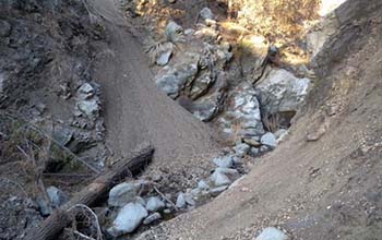
Sediment loading is key to predicting post-wildfire debris flows��ͼ��
Sediment loading predicting post-wildfire debris flows
2020/2/20
The mudslides that follow wildfires in Southern California can be deadly -- and difficult to predict. New National Science Foundation-funded research will help officials identify areas prone to these ...
4D-SFM PHOTOGRAMMETRY FOR MONITORING SEDIMENT DYNAMICS IN A DEBRIS-FLOW CATCHMENT: SOFTWARE TESTING AND RESULTS COMPARISON
4D-SfM Photogrammetry Sediment dynamics monitoring Software comparison Debris flow hazard
2018/6/4
In recent years, the combination of Structure-from-Motion (SfM) algorithms and UAV-based aerial images has revolutionised 3D topographic surveys for natural environment monitoring, offering low-cost, ...
Stanford engineers design a robotic gripper for cleaning up space debris
Stanford engineers design robotic gripper cleaning up space debris
2017/7/24
Right now, about 500,000 pieces of human-made debris are whizzing around space, orbiting our planet at speeds up to 17,500 miles per hour. This debris poses a threat to satellites, space vehicles and ...
Researchers develop radar simulator to characterize scattering of debris in tornadoes
Researchers radar simulator scattering debris tornadoes
2017/7/19
Researchers have developed the first numerical polarimetric radar simulator to study and characterize the scattering of debris particles in tornadoes. (See video)
The results of their study are publi...
OU Researchers Develop Radar Simulator to Characterize Scattering Mechanisms of Debris Particles in Tornadoes
OU Researchers Radar Simulator Characterize Scattering Mechanisms Debris Particles Tornadoes
2017/7/19
A University of Oklahoma research team with the Advanced Radar Research Center has developed the first numerical polarimetric radar simulator to study and characterize scattering mechanisms of debris ...
Microscopic characterization and formation mechanisms of deepwater sandy-debris-flow and turbidity-current sandstones in a lacustrine basin: a case study in the Yanchang Formation of the Ordos Basin, China
Sandy debris flow Turbidite Ordos Basin Petrology Reservoir properties
2018/4/2
Deep-water deposition is a current issue in sedimentological research. Sandy-debris-flow sandstones and turbidity-current sandstones are the main types of sandstone that are the focus of considerable ...
ANALYSIS OF DEBRIS FLOW BEHAVIOR USING AIRBORNE LIDAR AND IMAGE DATA
Debris Flow LiDAR Digital Surface Model Geomorphologic Change
2016/11/30
The frequency of debris flow events caused by severe rainstorms has increased in Korea. LiDAR provides high-resolution topographical data that can represent the land surface more effectively than othe...
ANALYSIS OF DEBRIS FLOW DISASTER DUE TO HEAVY RAIN BY X-BAND MP RADAR DATA
M X-band MP radar GIS Disaster prevention Web-based
2016/11/30
On August 20 of 2014, Hiroshima City (Japan) was struck by local heavy rain from an autumnal rain front. The resultant debris flow disaster claimed 75 victims and destroyed many buildings. From 1:30 a...
ASSESSING THE SUITABILITY OF SIMULATED SAR SIGNATURES OF DEBRIS FOR THE USAGE IN DAMAGE DETECTION
SAR simulation debris damage detection texture features
2016/7/28
When disasters strike in urban areas, the most important issue is to direct rescue forces to the most heavily destroyed areas. SAR images, because of their independence from daylight and weather condi...
HIGH-RESOLUTION DEBRIS FLOW VOLUME MAPPING WITH UNMANNED AERIAL SYSTEMS (UAS) AND PHOTOGRAMMETRIC TECHNIQUES
Unmanned Aerial Vehicle Structure-from-motion Natural Hazards Volumetric Sediment Budget Digital Terrain Models Event Documentation
2016/7/5
Debris flows cause an average � 30 million damages and 1-2 fatalities every year in Austria. Detailed documentation of their extent and magnitude is essential for understanding, preventing and mitigat...
MULTI-TEMPORAL DEM MATCHING METHOD WITHOUT CONTROL POINTS IN DEBRIS-FLOW AREA
Photogrammetry Geomorphology Multitemporal Change Detection Matching Accuracy Precision
2015/12/29
Detecting the volume change of loose deposit of rock debris accumulated and debris discharged is one of the methods to study debris flow. The volume can be resulted by overlapping multi-temporal DEM. ...
Planetesimals to protoplanets�CII. Effect of debris on terrestrial planet formation
methods N-body simulations�Cmethods numerical�CSolar system formation�Cplanetary systems formation
2015/12/25
In this paper, we extend our numerical method for simulating terrestrial planet formation to include dynamical friction from the unresolved debris component. In the previous work, we implemented a rub...
Applying Digital Photogrammetry to Spatial Distribution of Debris Variation
Photogrammetry Debris Variation Geographic Information System (GIS)
2015/12/18
This study applies original aerial photographs to reconstruct orthoimages and extract digital terrain model (DTM) for images of various periods. The area of research is located at the Daluowan stream ...
Geophysical surveying of slopes affected by debris flows: the case of S. Felicea Cancello (Caserta, Southern Italy)
debris flow geophysical surveys S. Felice a Cancello
2015/9/17
This paper contains the results of a series of geophysical investigations carried out on the largest debris flow to
have taken place in Tavernole, S. Felice a Cancello (Caserta, Southern Italy). The ...
Turbidity currents and debris flows represent the most prominent processes of sediment transport from the shallow shelf waters into the deep ocean. These gravity driven flows are capable of transporti...
�й��о����������а�-��
- ���ڼ���...
�й�ѧ���ڿ����а�-��
- ���ڼ���...
�����ѧ���л������а�-��
- ���ڼ���...
�й���ѧ���а�-��
- ���ڼ���...
�ˡ���-ƪ
- ���ڼ���...
�Ρ���-ƪ
- ���ڼ���...
��������-ƪ
- ���ڼ���...
�������� -ƪ
- ���ڼ���...
֪ʶҪ��-ƪ
- ���ڼ���...
���ʶ�̬-ƪ
- ���ڼ���...
��������-ƪ
- ���ڼ���...
ѧ��ָ��-ƪ
- ���ڼ���...
ѧ��վ��-ƪ
- ���ڼ���...

