搜索结果: 1-15 共查到“bedrock”相关记录23条 . 查询时间(0.078 秒)

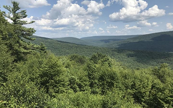
Bedrock type under forests greatly affects tree growth, species, carbon storage(图)
Bedrock type under forests greatly tree growth species carbon storage
2020/6/19
A forest's ability to store carbon depends on the bedrock beneath, according to Penn State researchers who studied forest productivity and composition and the physical characteristics of roc...
Radio Echo Sounding (RES) investigations at Talos Dome (East Antarctica): bedrock topography and ice thickness
radio echo sounding radio glaciology ice thickness measurements
2015/9/17
Radio echo sounding measurements were collected during two Antarctic expeditions to determine the ice thickness
and the sub-glacial morphology of Talos Dome in the region around 72°48'S; 159°06'E (ab...
Systematic geochemical study of the soils, litter, and bedrock of a Permian limestone mountain, Central Japan
chemical composition enrichment factor nutrient plant
2015/3/9
The paper deals with the results of a systematic geochemical study of soils at Mt Kinshozan in Central Japan, a limestone area known for its well-preserved Permian fossils. Compared with the typical c...
Evaluation of ground penetrating radar and vertical electrical sounding methods to determine soil horizons and bedrock at the locality Dehtare
geophysical method parent rock soil layer soil survey
2015/3/9
Recently, geophysical methods have been widely used in many fields including pedology. Two of them, ground penetrating radar (GPR) and vertical electrical sounding (VES) were employed at the Dehtá"...
IMAGE CLASSIFICATION FROM LANDSAT TM, AIRBORNE MAGNETICS AND DEM DATA FOR MAPPING PALEOPROTEROZOIC BEDROCK UNITS, BAFFIN ISLAND, NUNAVUT, CANADA
Bedrock Mapping Geology Classification Remote Sensing Nunavut
2015/2/4
A novel approach in image classification to bedrock mapping is applied to a 1:100 000 scale map area
of the Meta Incognita Peninsula Baffin Island, Nunavut, Canada to support mapping of the
Paleopro...
Spatial correlation between radon ( 222 Rn) in groundwater and bedrock uranium ( 238 U): GIS and geostatistical analyses
radon uranium groundwater bedrock GIS Kriging IDW
2014/11/12
This study describes approaches to create surface maps of radon in groundwater based on
measurements of radon (
222
Rn) in drilled bedrock wells at unevenly distributed sites and uranium
bedrock m...
Development and verification of conceptual models to characterize the fractured bedrock aquifer of the Nashoba terrane, Massachusetts
Discrete fracture network the DFN gil rock fabric lithology and underground water
2014/10/22
This dissertation is a composite of several studies. First, three of the most common fracture sampling techniques are tested against each other to evaluate the effectiveness of each method to adequate...
University of California, Berkeley, geologist William Dietrich pioneered the application of airborne LIDAR – light detection and ranging – to map mountainous terrain, stripping away the vegetation to ...
Vegetation and wildfire controls on sediment yield in bedrock landscapes
Vegetation and wildfire controls sediment yield bedrock landscapes
2014/4/8
Steep, rocky landscapes commonly exhibit high sediment yields and are especially sensitive to climate, tectonics,and wildfire. Predicting landscape response to these perturbations demands a quantitati...
Experimental study on coarse grain saltation dynamics in bedrock channels
Experimental study coarse grain saltation dynamics bedrock channels
2014/4/8
Saltation of bed load particles on bedrock surfaces is important for landscape evolution and bedrock incision in steep landscapes. However, few studies have investigated saltation in bedrock channels ...
Sediment storage by vegetation in steep bedrock landscapes: Theory, experiments, and implications for postfire sediment yield
Sediment storage by vegetation steep bedrock landscapes Theory experiments implications postfire sediment yield
2014/4/8
Mechanistic models for sediment transport on hillslopes are needed for applications ranging from landscape evolution to debris-flow hazards. Progress has been made for soil-mantled landscapes; however...
IN SITU MEASUREMENT OF BEDROCK EROSION
close range photogrammetry structured light geomorphology erosion
2014/4/28
While long term erosion rates of bedrock material may be estimated by dating methods, current day erosion rates are – if at all available – based on rough estimates or on point measurements. Precise q...
A discrete random model describing bedrock profile abrasion
discrete random model bedrock profile abrasion Geophysics
2011/8/4
Abstract: We use a simple, collision-based, discrete, random abrasion model to compute the profiles for the stoss faces in a bedrock abrasion process. The model is the discrete equivalent of the gener...
Rapid formation of a modern bedrock canyon by a single flood event
Rapid formation modern bedrock canyon single flood event
2014/4/8
Deep river canyons are thought to form slowly over geological time (see, for example, ref. 1), cut by moderate flows that reoccur every few years2,3. In contrast, some of the most spectacular canyons ...
Fracture lineaments and their surroundings with respect to groundwater flow in the bedrock of Sunnfjord,Western Norway
Fracture lineaments surroundings groundwater flow bedrock of Sunnfjord
2009/12/3
Assumptions about groundwater flow based on observations from single-well test sites and a multi-well test site were evaluated by statistical methods on a regional data set of borehole flow rates and ...

