搜索结果: 1-15 共查到“水文学 Flood”相关记录95条 . 查询时间(0.109 秒)

Inland flood threat increasing in South Florida(图)
Inland flood threat increasing South Florida
2017/12/19
As South Florida raises groundwater levels to fight saltwater intrusion, the threat of inland flooding will only increase, according to newly published research results.Although high groundwater level...

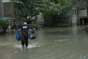
Decade of data shows FEMA flood maps missed 3-in-4 claims(图)
Decade data FEMA flood maps missed 3-in-4 claims
2017/9/20
An analysis of flood claims in several southeast Houston suburbs from 1999 to 2009 found that the Federal Emergency Management Agency’s 100-year flood plain maps — the tool that U.S. officials use to ...
Flood susceptible mapping and risk area delineation using logistic regression, GIS and remote sensing
Flood susceptibility analysis logistic regression model
2015/8/14
Recently, in the year 2006, 2007 and 2008 heavy monsoons rainfall have triggered floods along Malaysia's east coast as well as in different parts of the country. The hardest hit areas are along the ea...
How to reach a compromise solution on technical and non-structural flood control measures
agreement averaging operator consensus environmental decision making flood risk management fuzzy uncertainty multi-aspect decision
2015/3/10
Harmful impacts of floods are the result of an interaction between extreme hydrological events and environmental, social, and economic processes. Flood management should consider many diverse aspects ...
Analysis of land use change in the Eastern Ore Mts. regarding both nature protection and flood prevention
hydrological modeling runoff generation land use change
2015/2/3
Two different models (WBS FLAB, WaSiM-ETH) were used in the project HochNatur (flood prevention and nature conservation in the Weißeritz catchment in the Eastern Ore Mts. – Erzgebirge) to determi...
Flood susceptible mapping and risk area delineation using logistic regression, GIS and remote sensing
Flood susceptibility analysis logistic regression model Geographic Information System GIS Remote Sensing
2015/1/8
Recently, in the year 2006, 2007 and 2008 heavy monsoons rainfall have triggered floods along Malaysia's east coast as well as in different parts of the country. The hardest hit areas are along the ea...
APPLICATION OF A RATIONAL MODEL IN GIS FOR FLOOD RISK ASSESSMENT IN ACCRA, GHANA
Flood Hazard Mapping GIS Integration
2014/11/12
Accra has been experiencing periodic flooding that affect properties and lives. The government
seeing the dangers involved has commissioned institutions such as Ministry of Works and
Housing, Town a...
ISTSOS, SENSOR OBSERVATION MANAGEMENT SYSTEM: A REAL CASE APPLICATION OF HYDRO-METEOROLOGICAL DATA FOR FLOOD PROTECTION.
:SOS sensors observations services OGC monitoring
2014/4/24
istSOS (Istituto scienze della Terra Sensor Observation Service) is an implementation of the Sensor Observation Service standard
from Open Geospatial Consortium (OGC). The development of istSOS star...
Estimation of high return period flood quantiles using additional non-systematic information with upper bounded statistical models
return period flood quantiles additional non-systematic information
2010/12/22
This paper proposes the estimation of high return period quantiles using upper bounded distribution functions with Systematic and additional Non-Systematic information. The aim of the developed method...
Design flood hydrographs from the relationship between flood peak and volume
Design flood hydrographs relationship between flood peak volume
2010/12/22
Hydrological frequency analyses are usually focused on flood peaks. Flood volumes and durations have not been studied as extensively, although there are many practical situations, such as when designi...
Design flood hydrographs from the relationship between flood peak and volume
Design flood hydrographs relationship flood peak and volume
2010/12/22
Hydrological frequency analyses are usually focused on flood peaks. Flood volumes and durations have not been studied as extensively, although there are many practical situations, such as when designi...
Reference crop evapotranspiration derived from geo-stationary satellite imagery: a case study for the Fogera flood plain, NW-Ethiopia and the Jordan Valley, Jordan
Reference crop evapotranspiration geo-stationary satellite imagery
2010/12/22
First results are shown of a project aiming to estimate daily values of reference crop evapotranspiration ET0 from geo-stationary satellite imagery. In particular, for Woreta, a site in the Ethiopian ...
Annual maximum discharge is analyzed in the Mekong river in Southeast Asia with regard to trends in average flood and trends in variability during the 20th century. Data from four gauging stations dow...
Multi-model comparison of a major flood in the groundwater-fed basin of the Somme River (France)
Multi-model comparison major flood groundwater-fed basin Somme River
2010/2/1
The Somme River Basin is located above a chalk aquifer and the discharge of the somme River is highly influenced by groundwater inflow (90% of river discharge is baseflow). In 2001, the Somme River Ba...
Decision support system for urban flood management
Decision support system urban flood management
2009/12/4
This paper presents the development of a decision support system (DSS) for flood warning and instantiation of restoration activities in two urban areas, the Liguria Region in Italy and the Greater Ath...

