搜索结果: 1-15 共查到“地质学 approach”相关记录30条 . 查询时间(0.125 秒)

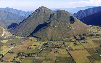
Geoscientists develop new approach to understanding massive volcanic eruptions(图)
Geoscientists approach massive volcanic eruptions
2021/1/18
A team of geoscientists has developed a new way to reconstruct the sizes of volcanic eruptions that occurred thousands of years ago, creating a first-of-its kind tool that can aid in understanding pas...
中国地质大学科学技术发展院谢爽(博士研究生),文章*, 等,环境学院. Journal of Hydrology (2019), A new model approach for reactive solute transport in dual-permeability media with depth-dependent reaction ,coefficients
土壤;污染物;迁移
2021/10/15
近日,国际著名期刊《Journal of Hydrology》刊发了中国地质大学环境学院文章教授团队的最新研究成果——“A new model approach for reactive solute transport in dual-permeability media with depth-dependent reaction coefficients”。该文第一作者为环境学院2018级博士...

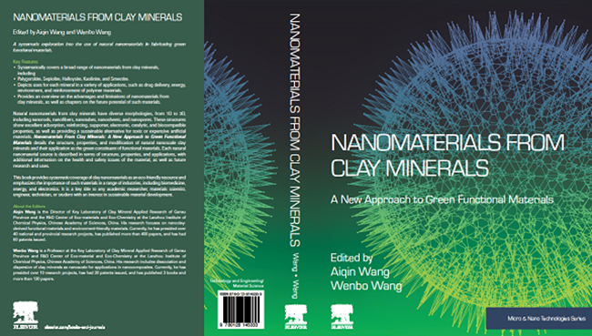
中国科学院兰州化学物理研究所主编的《Nanomaterials From Clay Minerals: A New Approach to Green Functional Materials》出版发行(图)
中国科学院兰州化学物理研究所 出版发行 黏土矿物 功能材料
2019/8/28
2019年8月14日,由中国科学院兰州化学物理研究所甘肃省黏土矿物应用研究重点实验室王爱勤研究员和王文波研究员共同主编的《Nanomaterials From Clay Minerals: A New Approach to Green Functional Materials》(ISBN: 9780128145333)一书由Elsevier出版社出版发行。 该书隶属于“Micro and Nan...
HIGH-RESOLUTION ENHANCED PRODUCT BASED ON SMAP ACTIVE-PASSIVE APPROACH USING SENTINEL 1A AND 1B SAR DATA
soil moisture microwave remote sensing active-passive algorithm SMAP Sentinel-1A -1B
2019/2/27
SMAP project released a new enhanced high-resolution (3km) soil moisture active-passive product. This product is obtained by combining the SMAP radiometer data and the Sentinel-1A and -1B Synthetic Ap...
GEOINFORMATION APPROACH FOR COMPLEX ANALYSIS OF MULTIPLE NATURAL HAZARD
Natural hazards Geoinformation GIS, Floods Landslides Complex analysis
2018/4/18
Natural hazards are existence of natural components and processes, which create a situation that could negatively affect people, the economy and the environment. In this concern, they are associated w...
GEOINFORMATION APPROACH FOR COMPLEX ANALYSIS OF MULTIPLE NATURAL HAZARD
Natural hazards Geoinformation GIS Floods Landslides Complex analysis
2018/5/8
Natural hazards are existence of natural components and processes, which create a situation that could negatively affect people, the economy and the environment. In this concern, they are associated w...
FLOOD VULNERABILITY REDUCTION, USING A PARTIAL PARTICIPATORY GIS APPROACH. A STUDY CASE IN BAJA CALIFORNIA SUR, MEXICO
Participatory cartography loods cyclones vulnerability reduction
2018/4/18
A partial participatory GIS approach was implemented in a community in La Paz, Baja California Sur, Mexico to reduce vulnerability of floods caused by cyclones. A workshop was held to locate areas sus...
A MULTI-SOURCE DATA APPROACH FOR THE INVESTIGATION OF LAND SUBSIDENCE IN THE KONYA BASIN, TURKEY
Remote Sensing Differential SAR Interferometry (DInSAR) Small BAseline Subset (SBAS) GRACE Subsidence Sinkholes Groundwater Turkey
2018/4/18
Groundwater depletion caused by rapid population growth, global climate change, water resources overexploitation is a major concern in many regions of the world. Consequences are not limited to a non-...
A MULTI-SOURCE DATA APPROACH FOR THE INVESTIGATION OF LAND SUBSIDENCE IN THE KONYA BASIN, TURKEY
Remote Sensing Differential SAR Interferometry (DInSAR) Small BAseline Subset (SBAS) GRACE Subsidence Sinkholes Groundwater Turkey
2018/5/8
Groundwater depletion caused by rapid population growth, global climate change, water resources overexploitation is a major concern in many regions of the world. Consequences are not limited to a non-...
Researchers Develop Novel Approach for Quantifying Nitrate Discharge from Groundwater to Streams
Researchers Quantifying Nitrate Discharge Groundwater Streams
2016/11/29
Novel groundwater sampling (age, flux, and nitrate) carried out beneath a streambed and in wells was used to estimate (1) the current rate of change of nitrate storage, dSNO3/dt, in a contaminated unc...
Monitoring active volcanoes: The geochemical approach
Active volcanoes geochemistry volcanic activity lava dissolving volatiles
2015/8/27
The geochemical surveillance of an active volcano aims to recognize possible signals that are related to changes in volcanic activity. Indeed, as a consequence of the magma rising inside the volcanic ...
Defining high-detail hazard maps by a cellular automata approach: application to Mount Etna (Italy)
automata approach Mount Etna
2015/8/27
The individuation of areas that are more likely to be affected by new events in volcanic regions is of fundamental relevance for the mitigation of the possible consequences, both in terms of loss of h...
The study of the landscape: from a holistic approach to a social concept of knowledges
Educational History of Science Public Issues Geoethics Geomorphology Society Cultural heritage Landscape
2015/8/26
Three examples of the study and enhancement of the landscape in Italy are presented. The interdisciplinary approach to this topic is carried out not simply by juxtaposing disciplines, but by the integ...
A RATIONAL APPROACH TO DIGITAL ANCILLARY DATA ACCESS AND VISUALIZATION IN LAND COVER, LAND USE PROJECTS
Land Cover Land Use Interpretation aerial photographs Rectification Orthorectification database GIS
2015/7/29
During the last decade many national and regional Land Cover/Land Use projects are implemented based on computer aided satellite
image interpretation. An essential procedure for the European CORINE ...
Matching Historic Renders Using Locally-Available Materials:The Art and Science – A Conservator’s Approach
lime mortar conservation science bicarbonate consolidation aggregate-binder ratio
2011/11/14
The replication of these renders is one part of a larger conservation process that includes documenting the building’s construction history, mapping deterioration and determining the underlying causes...

