搜索结果: 1-15 共查到“地理学 Development”相关记录45条 . 查询时间(0.2 秒)
Winter Climate Shapes Spring Phytoplankton Development in Non-Ice-Covered Lakes: Subtropical Lake Taihu as an Example
Subtropical Lake Taihu Winter Climate Spring Phytoplankton
2021/7/28
Winter warming plays a vital role in spring phytoplankton community succession in temperate lakes due to variation of ice cover duration in winter.
中国科学院地理科学与资源研究所与国际区域研究协会联合创办的学术期刊Area Development and Policy被Scopus收录
中国科学院地理科学与资源研究所 国际区域研究协会 学术期刊 Area Development and Policy Scopus 收录
2018/7/25
2018年7月12日,由中国科学院地理科学与资源研究所与国际区域研究协会联合创办、Taylor & Francis出版发行的学术期刊Area Development and Policy正式被Scopus收录。这是继被ESCI收录之后,Area Development and Policy再次被世界顶级期刊引文索引数据库收录。Scopus 内容甄选委员会高度赞扬了Area Development ...
中国科学院地理科学与资源研究所与国际区域研究协会联合创办的学术期刊Area Development and Policy被ESCI收录
中国科学院地理科学与资源研究所 国际区域研究协会联合创办的学术期刊 Area Development and Policy ESCI
2018/6/22
根据Taylor & Francis出版社的通知,由中国科学院地理科学与资源研究所与国际区域研究协会(Regional Studies Association, RSA)联合创办、Taylor & Francis出版发行的学术期刊Area Development and Policy正式被ESCI (Emerging Sources Citation Index) 收录。
DEVELOPMENT AND APPLICATION OF THE KEY TECHNOLOGIES FOR THE QUALITY CONTROL AND INSPECTION OF NATIONAL GEOGRAPHICAL CONDITIONS SURVEY PRODUCTS
Geographical Condition Survey Quality Control Quality Inspection and Testing Total Quality Control Target Survey Products
2018/5/17
The First National Geographical Condition Survey is a predecessor task to dynamically master basic situations of the nature, ecology and human activities on the earth’s surface and it is the brand-new...

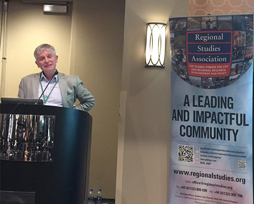
“Area Development and Policy”举办地理学家美洲联合会2018年会年度报告分会场(图)
Area Development and Policy 地理学家 美洲联合会 2018年
2018/4/20
2018年4月10-14日,地理学家美洲联合会(AAG)2018年会在美国路易斯安那州新奥尔良市举行。当地时间4月13日下午,由中国科学院地理科学与资源研究所与国际区域研究协会(Regional Studies Association, RSA)联合创办、Taylor & Francis出版社出版发行的学术期刊Area Development and Policy(ADP《地区发展与政策》)在此次...

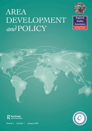
中国科学院地理科学与资源研究所与国际区域研究协会合办新期刊-- Area Development and Policy 第1期上线(图)
中国科学院地理科学与资源研究所 国际区域研究协会 Area Development and Policy
2016/5/9
由中国科学院地理科学与资源研究所与国际区域研究协会(Regional Studies Association, RSA)联合创办、Taylor & Francis 出版社出版发行的学术期刊Area Development and Policy (《地区发展与政策》)第一期内容已于2016年4月29日上线。期刊网址:http://www.tandfonline.com/toc/rard20...

学术期刊“Area Development and Policy”创刊发布会在美国旧金山举行(图)
学术期刊Area Development and Policy 创刊发布会 美国旧金山
2016/4/7
美国当地时间2016年3月30日下午,由区域研究协会(Regional Studies Association, RSA)和中国科学院地理科学与资源研究所联合创办、Taylor & Francis出版社出版发行的学术期刊“Area Development and Policy(ADP)”,在2016年美国地理学会年会上举行了创刊发布会。发布会在旧金山联合广场希尔顿酒店Imperial B报告厅举行...
CONCEPTUAL DEVELOPMENT OF AN ASSISTANT FOR CHANGE DETECTION AND ANALYSIS BASED ON REMOTELY SENSED SCENES
change detection and analysis geovisualization spatio-temporal visual interpretation
2015/9/28
Because automatic methods for thematic interpretation purposes are not (yet) able to handle complex data sources and criteria, we
propose to go back to, respectively to integrate, the classical visu...
NSF,National Geospatial-Intelligence Agency support development of new Arctic maps
NSF National Geospatial-Intelligence Agency new Arctic maps
2015/9/8
The National Science Foundation (NSF), in partnership with the National Geospatial-Intelligence Agency (NGA), is supporting development of high-resolution topographic maps of the Arctic that for the f...
Algorithmic Development of an Optimal Path Computation Model Based on Topographic Map Features
GIS Mapping Modelling,
2015/7/6
Path finding problems have attracted widespread research interests with different GIS-T applications such as Logistics applications,
Infrastructure Planning and Travel Demand analysis. Previous resea...
The SPRINTARS version 3.80/4D-Var data assimilation system: development and inversion experiments based on the observing system simulation experiment framework
SPRINTARS development inversion experiments
2014/12/12
We present an aerosol data assimilation system
based on a global aerosol climate model (SPRINTARSSpectral Radiation-Transport Model for Aerosol Species)
and a four-dimensional variational data assim...
Online web GIS- based services for spatial data and sharing of leptospirosis epidemiology information; Development of pilot project in Mahasarakham province Thailand
Web GIS-based service spatial data sharing leptospirosis epidemiology
2014/11/26
Leptospirosis epidemiology Information sharing is important for the shared preparation,
response, and recovery stages of sickness control. Leptospirosis epidemiology phenomena
are powerfully assoc...
Development of an economical Spatial health information system
Health open source spatial data Malaria WebGIS
2014/11/26
This study outlines the economical development of Dehradun Malaria Information System
(DMIS) using open source internet GIS technologies and concepts. The application is
developed with three objec...
Morphometric analysis using Geographic Information System (GIS) for sustainable development of hydropower projects in the lower Satluj river catchment in Himachal Pradesh, India
Morphometric classification Drainage density Stream orders Hydropower
2014/11/24
Remote Sensing and Geographic Information System techniques are effectively being used in
recent times as an important tool in determining the quantitative description of morphometry
of a basin. T...
Geo-informatics application in response to tsunami disaster and preparation of development plans for eastern coast of Ampara District, Sri Lanka
Tsunami disaster management Srilanka
2014/11/19
The natural disasters experienced by south Asian region are water-related either through excess
water or a lack of it namely typhoons and cyclones, flooding, storm surges, tsunamis, drought
and de...

